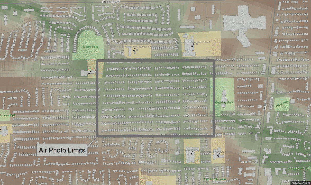
From the late 1940's to late 1950's a tributary of the Don River in the Newtonbrook neighbourhood of North York was diverted and enclosed, fully replaced by residential development by the late 1960's. The transition in this area west of Yonge Street and south of Steeles Ave. W. is shown below (source Toronto archives, compiled by Toronto Water) :
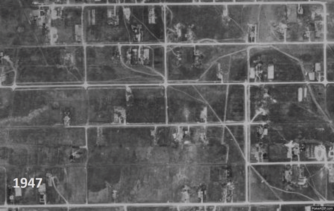 |
| Newtonbrook development 1947 - 1969, former North York, City of Toronto |
The Newtonbrook tributary was not preserved although it conveyed runoff from over 250 hectares of land (2.5 square kilometers). The following images show the overland flow path through the area, including multiples of the estimated 100 year flow spread (1 time, 2 times and 4 times width), and basement flooding locations reported in May 2000 (orange), August 2005 (red), and July 2013 (yellow):
 |
| Overland flow path and 100 year flow spread (1 x, 2 x and 4 x) and historic basement flooding locations. |
Today stormwater management practices would control the quantity of runoff from new development so that it matches pre-development peak flows during extreme rainfall events. This practice did not become widespread until the 1980's in Ontario. The Newtonbrook drainage catchment would have been controlled by about 5 or more stormwater ponds using today's standards (about one pond every 50 hectares).
Just over 35,000 Toronto properties are centered in the 100 year flow spread limits estimated through CityFloodMap.Com's overland flow and flood risk analysis. In many cases, like in the Newtonbrook area, these flow limits correspond to areas of high basement flooding risk given that the overland flow system can overwhelm the local sewer system with significant extraneous inflows during extreme storm events. City-wide analysis of overland flow risks and basement flooding correlation is presented in the following slides: