Using Environment Canada's data and research, we have shown that rainfall intensities have not increased in southern Ontario here. In fact there are more statistically significant rain intensity decreases than increased south of 44 degrees. So the rainfall influence on runoff is not increasing. But runoff has been increasing after decades of urbanization under the today's stable or decreasing rainfall intensities.
The following maps show urban expansion in Mississauga, Oakville and Burlington Ontario from 1966 to about 2000 (data varies from 1999 to 2002). The overland flow system path based on Ontario conditioned digital elevation model is superimposed on the land use map so that the impact of urbanization and runoff into the drainage system can be considered.
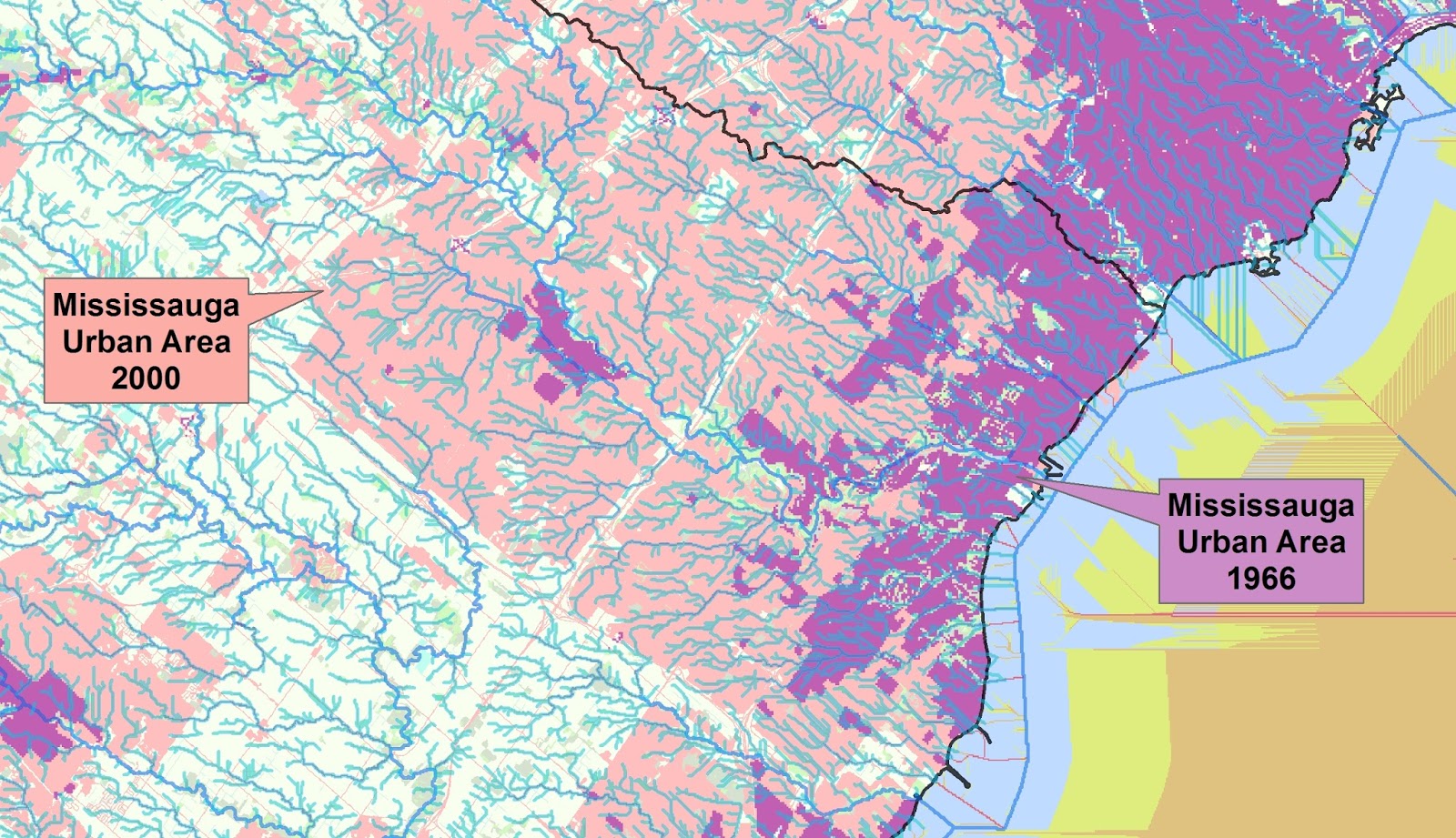
The effect of urbanization in Mississauga on runoff would be most acute in the smaller watersheds (e.g., not the Credit), where the upstream urban area has increased significantly since 1966.

Likewise in Oakville - Bronte Creek, a large watershed more slightly influenced by the city's sprawl, has not been affected to the same degree as the smaller Fourteen Mile Creek to the west, where a high relative change in land use over that smaller watershed has occurred throughout the city.

Same in Burlington - many small creek watersheds originating off the escarpment have dramatically increased urbanization over three decades. Burlington is characterized by creeks that have been realigned, straightened and encroached upon. These can be expected to be more sensitive to increased runoff rates due to expanded urbanization.
***
Parts of Hamilton have been urbanized up to the watershed divide (black line) by the late 1990's / early 2000's. How does this affect runoff into the old 'core' built to pre-1960's standards?
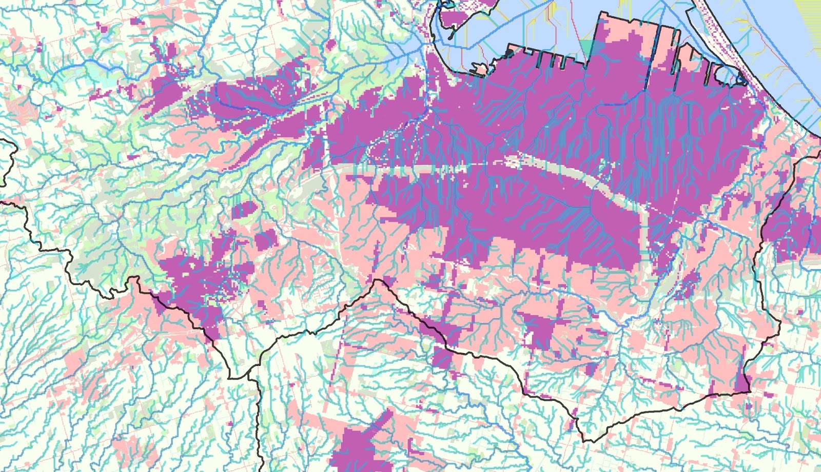
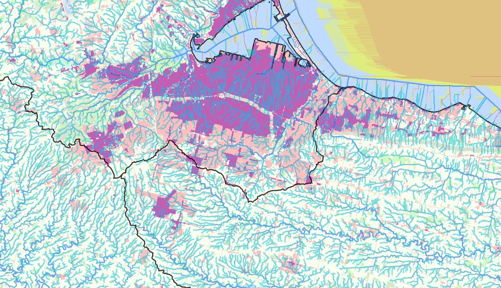
Hamilton, wider perspective. Some wetlands remaining upstream of Dundas? :
Richmond Hill (Lake Wilcox near upper middle of map). Some urbanization around the lake flows to the Humber where flow impacts would be muted, while other areas to the south flow flow to headwater tributaries of the Don and Rouge:
