
* See updated Merritt, B.C map link at bottom (Nov. 2021)
British Columbia maintains a comprehensive index of maps showing floodplains, or flood hazard limits / flood areas, throughout the province of BC. These maps illustrate flood risks associated with large river systems as opposed to urban overland flow systems that can cause urban flooding.
The map to the right is an overview of BC flood map areas. Use the links in the list below to find the floodplain map for a particular river, creek, reservoir or lake.
To the left is an example of a floodplain map for a particular area - in this case for Langley, B.C. (click to enlarge). Zooming in shows buildings and properties that lie within the flood risk zone. I have spliced together parts of two maps to show an area near the Langley Bypass and Frazer Highway with residential properties within the flood hazard area.
The maps show over a hundred buildings within the risk zone. Remember this map shows the limits for a 200-year floodplain - this is the limit of river flooding during a 200-year rainfall event, which is and extreme storm having a chance of occurring of 0.5% every year (1/200%). While this seems rare, if you lived in one of the buildings at the edge of the flood hazard (i.e., right on the floodline), you would have had a 22% change of being flooded over that period. This risk is often misreported by saying you would expect that flood event once in every 200 years (this implies a 100% chance over that period). In fact in 200 years there is only a 63% chance of being flooded.
Th bird's eye view shows some of the variation in flooding depth based on the map's topographic elevations and flood elevations that vary along the river length. You can see that the flood depth varies considerably. The townhomes that have 130 cm of flooding during that flood would have a much higher chance of being flooded during a smaller storm than those with only 10 cm of flooding during the 200 year flood event. Alternatively, for any given storm, the flood damages would be greater the closer the building is to the valley bottom with deeper flooding.
Based on flood risk mapping, do you need flood insurance for your property? Find and insurance broker through the The Insurance Brokers Association of B.C. here.
Here are the links to the available floodplain maps in BC (*update Nov. 2021 - get newest links here: https://www2.gov.bc.ca/gov/content/environment/air-land-water/water/drought-flooding-dikes-dams/integrated-flood-hazard-management/flood-hazard-land-use-management/floodplain-mapping/floodplain-maps-by-region):
Birkenhead River (see Lillooet River) Drawing No. 88-44 Sheets 1 to 11 - Designation Date 90/09/30
Bonaparte River Drawing No. 93-12 Sheets 1 to 3 - Designation Date 96/09/30
Buck Creek (see Bulkley River at Houston) Drawing No. 85-14 Sheets 1 to 3 - Designation Date 87/12/03
Bulkley River at Houston (including Buck Creek) Drawing No. 85-14 Sheets 1 to 3 - Designation Date 87/12/03
Bulkley River: Quick Area* Drawing No. 86-23 Sheets 1 to 4 - Designation Date 88/09/30
Bulkley River: Quick to Houston* Drawing No. 96-10 Sheets 1 to 6 - Designation Date 98/09/30
Bulkley River (see Skeena and Bulkley Rivers at Hazelton) Drawing No. 91-1 Sheet 1 - Designation Date 94/09/30
Bulkley and Telkwa Rivers: Smithers - Telkwa
Kitimat River Drawing No. A5328 Sheets 1 to 11 - Designation Date 87/12/03
Kitsumkalum River (see Skeena R.: Lakelse-Terrace-Usk) Drawing No. 5375 Sheets 1 to 9 of 13 - Designation Date 87/12/03
Koksilah River (see Cowichan River) Drawing No. 91-19 Sheets 1 to 3 - Designation Date 97/09/30
Kootenay River: Columbia Lake at Canal Flats Drawing No. 89-41 Sheets 1 to 8 - Designation Date 91/09/30
Kootenay River: Kootenay Lake - U.S. Border Drawing No. A5278 Sheets 1 to 6 - Designation Date 90/09/30
Kuskanax Creek (See Arrow Reservoir & Kuskanax Creek) Drawing No. 93-11 Sheet 1 - Designation Date 98/09/30
Salmon and White Rivers Drawing No. A5282 Sheets 1 to 6 - Designation Date 87/12/03
Serpentine and Nicomekl Rivers
Somass River Drawing No. 93-10 Sheets 1 to 4 - Designation Date 97/09/30
Somenos Lake (see Cowichan River) Drawing No. 91-19 Sheets 1 to 6 - Designation Date 97/09/30
Sooke River* Drawing No. 91-4 Sheets 1 to 2 - Designation Date 95/09/30
South Thompson River: Kamloops - Chase
Drawing No. A5286 Sheets 1 to 6 - Designation Date 87/12/03
Tsolum River (see Courtenay, Puntledge and Tsolum Rivers)
Tulameen River (see Similkameen River at Princeton)
Drawing No. 91-22 Sheets 1 & 2 - Designation Date 95/09/30
Tulameen River at Tulameen Drawing No. A5294 Sheets 1 to 4 - Designation Date 87/12/03
The map to the right is an overview of BC flood map areas. Use the links in the list below to find the floodplain map for a particular river, creek, reservoir or lake.
 |
| Langley Floodplain Map |
 |
| Close-up of buildings in flood risk zone. |
 |
| Variable river flooding depths for rare event. |
Th bird's eye view shows some of the variation in flooding depth based on the map's topographic elevations and flood elevations that vary along the river length. You can see that the flood depth varies considerably. The townhomes that have 130 cm of flooding during that flood would have a much higher chance of being flooded during a smaller storm than those with only 10 cm of flooding during the 200 year flood event. Alternatively, for any given storm, the flood damages would be greater the closer the building is to the valley bottom with deeper flooding.
Based on flood risk mapping, do you need flood insurance for your property? Find and insurance broker through the The Insurance Brokers Association of B.C. here.
Here are the links to the available floodplain maps in BC (*update Nov. 2021 - get newest links here: https://www2.gov.bc.ca/gov/content/environment/air-land-water/water/drought-flooding-dikes-dams/integrated-flood-hazard-management/flood-hazard-land-use-management/floodplain-mapping/floodplain-maps-by-region):
A
Alouette and North Alouette Rivers
Drawing No. 89-44 Sheets 1 & 2 - Designation Date 91/09/30
Alpha Lake* (see Whistler Area)
Drawing No. 89-16 Sheets 1 to 4 - Designation Date 93/09/30
Alta Creek* (see Whistler Area)
Drawing No. 89-16 Sheets 1 to 4 - Designation Date 93/09/30
Arrow Reservoir & Kuskanax Creek (Village of Nakusp)
Drawing No. 93-11 Sheet 1 - Designation Date 98/09/30
B
Baker Creek* (see Fraser and Quesnel R.) Drawing No. 89-43 Sheets 1 to 5 - Designation Date 92/09/30
Bear River at Stewart* Drawing No. 91-30 Sheets 1 & 2 - Designation Date 93/09/30
Beaver Creek - Beaver Falls to Meadows Drawing No. 88-35 Sheets 1 to 5 - Designation Date 90/03/31
Bear River at Stewart* Drawing No. 91-30 Sheets 1 & 2 - Designation Date 93/09/30
Beaver Creek - Beaver Falls to Meadows Drawing No. 88-35 Sheets 1 to 5 - Designation Date 90/03/31
Bella Coola River
- Drawing No. 87-56 Sheets 1 to 5 of 10 - Designation Date 89/09/30
- Drawing No. 87-56 Sheets 6 to 10 - Designation Date 89/09/30
Birkenhead River (see Lillooet River) Drawing No. 88-44 Sheets 1 to 11 - Designation Date 90/09/30
Bonaparte River Drawing No. 93-12 Sheets 1 to 3 - Designation Date 96/09/30
Buck Creek (see Bulkley River at Houston) Drawing No. 85-14 Sheets 1 to 3 - Designation Date 87/12/03
Bulkley River at Houston (including Buck Creek) Drawing No. 85-14 Sheets 1 to 3 - Designation Date 87/12/03
Bulkley River: Quick Area* Drawing No. 86-23 Sheets 1 to 4 - Designation Date 88/09/30
Bulkley River: Quick to Houston* Drawing No. 96-10 Sheets 1 to 6 - Designation Date 98/09/30
Bulkley River (see Skeena and Bulkley Rivers at Hazelton) Drawing No. 91-1 Sheet 1 - Designation Date 94/09/30
Bulkley and Telkwa Rivers: Smithers - Telkwa
- Drawing No. 84-68 Sheets 1 to 4 of 8 - Designation Date 87/12/03
- Drawing No. 84-68 Sheets 5 to 8 - Designation Date 87/12/03
C
Campbell and Quinsam Rivers Drawing No. 88-28 Sheets 1 & 2 - Designation Date 90/03/31
Cheakamus River Drawing No. 85-15 Sheets 1 to 3 - Designation Date 87/12/03
Chemainus River Drawing No. 89-10 Sheets 1 to 3 - Designation Date 91/09/30
Chilako River Drawing No. 93-1Sheets 1 to 3 Designation Date 97/09/30
Chilliwack River: Vedder Crossing - Slesse Creek Drawing No. A5283 Sheets 1 to 6 Designation Date 87/12/03
Christina Lake
- Drawing No. 89-1 Sheets 1 to 2 of 5 - Designation Date 91/09/30
- Drawing No. 89-1 Sheets 3 to 5 - Designation Date 91/09/30
Coldwater River (see Nicola R. - Canford to Nicola L.) Drawing No. 87-22 Sheet 13 - Designation Date 89/09/30
Columbia Lake (see Kootenay R. at Canal Flats) Drawing No. 89-41 Sheets 1 to 8 Designation Date 91/09/30
Columbia River: Columbia Lake to Windermere Lake Drawing No. A5286 Sheets 1 to 6 Designation Date 87/12/03
Columbia River at Golden Drawing No. A5186 Sheets 1 to 4 - Designation Date 87/12/03
Columbia River at Revelstoke Drawing No. 5514 Sheets 1 to 5 - Designation Date 87/12/03
Columbia River: Windermere Lake - Radium Drawing No. A5296 Sheets 1 to 9 - Designation Date 87/12/03
Copper River (see Zymoetz R.) Drawing No. 84-63 Sheet 1 - Designation Date 87/12/03
Coquihalla River at Hope* Drawing No. 85-27 Sheet 1 - Designation Date 88/09/30
Coquitlam River: Coquitlam Lake - Fraser River Drawing No. 5148 Sheets 1 to 7 Designation Date 87/12/03
Courtenay, Puntledge and Tsolum Rivers
- Drawing No. 89-13 Sheets 1 to 3 - Designation Date 91/09/30
- Drawing No. 8913 Sheets 4 to 7 - Designation Date 91/09/30
Cowichan and Koksilah Rivers and tributaries at Duncan Drawing No. 91-19 Sheets 1 to 6 - Designation Date 97/09/30
Cowichan River - River Bottom Road Area Drawing No. 91-33 Sheets 1 to 3 - Designation Date 97/09/30
Cowichan Lake Drawing No. 84-33 Sheets 1 to 6 - Designation Date 87/12/03
Crawford Creek: Alluvial Fan Drawing No. 86-4-3 sheet 1 - Designation Date 88/09/30
Cummings Creek (see Elk River and Michel Creek) Drawing No. 91-2 Sheets 1 to 3 of 5 - Designation Date 95/09/30
D
Duncan and Lardeau Rivers Drawing No. 93-3 Sheets 1 to 5 - Designation Date 96/09/30
Dutch Creek (see Columbia R: Columbia L. to Windermere L.) Drawing No. A5286 Sheets 1 to 6 - Designation Date 87/12/03
Duteau Creek (see Shuswap River, Bessette & Duteau Creeks) Drawing No. 96 - 7 Sheet 8 - Designation Date 98/09/30
Dutch Creek (see Columbia R: Columbia L. to Windermere L.) Drawing No. A5286 Sheets 1 to 6 - Designation Date 87/12/03
Duteau Creek (see Shuswap River, Bessette & Duteau Creeks) Drawing No. 96 - 7 Sheet 8 - Designation Date 98/09/30
E
- Drawing No. 87-30 Sheets 1 to 4 of 7 Designation Date 95/09/30
- Drawing No. 87-30 Sheets 5 to 7 - Designation Date 95/09/30
Elk River at Fernie Drawing No. A5196 Sheets 1 to 7 - Designation Date 87/12/03
Elk River and Michel Creek near Sparwood*
Elk River and Michel Creek near Sparwood*
- Drawing No. 91-2 Sheets 1 to 3 of 5 Designation Date 95/09/30
- Drawing No. 91-2 Sheets 4 to 5 - Designation Date 95/09/30
Elk River at Sparwood Drawing No. A5196 Sheets 1a & 2a - Designation Date 87/12/03
Englishman River Drawing No. 85-23 Sheets 1 to 7 - Designation Date 87/12/03
Erie Creek (see Salmo River) Drawing No. 90-32 Sheets 4 to 6 of 9 - Designation Date 91/09/30
Englishman River Drawing No. 85-23 Sheets 1 to 7 - Designation Date 87/12/03
Erie Creek (see Salmo River) Drawing No. 90-32 Sheets 4 to 6 of 9 - Designation Date 91/09/30
F
Fraser River near Hope* Drawing No. 87-1 Sheet 1 - Designation Date 88/09/30
Fraser and Nechako Rivers at Prince George Drawing No. 91-3 Sheets 1 to 12 Designation Date 97/09/30
Fraser and Quesnel Rivers at Quesnel* Drawing No. 89-43 Sheets 1 to 5 - Designation Date 92/09/30
Fraser and Nechako Rivers at Prince George Drawing No. 91-3 Sheets 1 to 12 Designation Date 97/09/30
Fraser and Quesnel Rivers at Quesnel* Drawing No. 89-43 Sheets 1 to 5 - Designation Date 92/09/30
G
Goat River at Creston Drawing No. 84-42 Sheets 1 & 2 - Designation Date 87/12/03
Granby River (see Kettle and Granby Rivers)
Granby River (see Kettle and Granby Rivers)
Green River (see Lillooet River) Drawing No. 88-44 Sheets 1 to 11 - Designation Date 90/09/30
Green River (see Whistler Area)* Drawing No. 89-16 Sheets 1 to 4 - Designation Date 93/09/30
Green River (see Whistler Area)* Drawing No. 89-16 Sheets 1 to 4 - Designation Date 93/09/30
H
Hirsch Creek (see Kitimat River)Drawing No. A5328 Sheets 1 to 11 - Designation Date 87/12/03
Hixon Creek (see Naver and Hixon Creeks at Hixon) Drawing No. 93-9 Sheets 1 to 3 - Designation Date 96/09/30
Hixon Creek (see Naver and Hixon Creeks at Hixon) Drawing No. 93-9 Sheets 1 to 3 - Designation Date 96/09/30
I
Illecillewaet River (see Columbia River at Revelstoke) Drawing No. 5514 Sheet 3 - Designation Date 87/12/03
K
- Drawing No. 90-34 Sheets 1 to 4 of 9 - Designation Date 92/09/30
- Drawing No. 90-34 Sheets 5 to 9 - Designation Date 92/09/30
Kitimat River Drawing No. A5328 Sheets 1 to 11 - Designation Date 87/12/03
Kitsumkalum River (see Skeena R.: Lakelse-Terrace-Usk) Drawing No. 5375 Sheets 1 to 9 of 13 - Designation Date 87/12/03
Koksilah River (see Cowichan River) Drawing No. 91-19 Sheets 1 to 3 - Designation Date 97/09/30
Kootenay River: Columbia Lake at Canal Flats Drawing No. 89-41 Sheets 1 to 8 - Designation Date 91/09/30
Kootenay River: Kootenay Lake - U.S. Border Drawing No. A5278 Sheets 1 to 6 - Designation Date 90/09/30
Kuskanax Creek (See Arrow Reservoir & Kuskanax Creek) Drawing No. 93-11 Sheet 1 - Designation Date 98/09/30
L
Lakelse River and Lake Drawing No. 88-29 Sheets 1 to 6 - Designation Date 90/09/30
Lardeau River (see Duncan and Lardeau Rivers) Drawing No. 93-3 Sheets 1 to 5 - Designation Date 96/09/30
Leiner River (see Tahsis and Leiner Rivers) Drawing No. 89-15 Sheets 1 & 2 - Designation Date 92/09/30
Lillooet River Drawing No. 88-44 Sheets 1 to 11 - Designation Date 90/09/30
Little Qualicum River Drawing No. 93-11 Sheet 1 - Designation Date 97/09/30
Little Slocan River (see Slocan River) Drawing No. 88-26 Sheets 1 to 11 - Designation Date 90/03/31
M
Mamquam River (see Squamish River) Drawing No. 5461 Sheets 1 to 10 - Designation Date 87/12/03
McKelvie Creek (see Tahsis and Leiner Rivers) Drawing No. 89-15 Sheets 1 & 2 - Designation Date 92/09/30
Michel Creek* (see Elk River and Michel Creek near Sparwood)
Drawing No. 91-2 Sheets 1 to 3 of 5 - Designation Date 95/09/30
Millar Creek (see Whistler Area)* Drawing No. 89-16 Sheets 1 to 4 - Designation Date 93/09/30
Miller Creek (see Lillooet River) Drawing No. 88-44 Sheets 1 to 11 - Designation Date 90/09/30
Mission CreekDrawing No. 84-43 Sheets 1 to 3 - Designation Date 87/12/03
N
Nahounli Creek* (see Stuart River and Lake) Drawing No. 89-42 Sheets 1 to 7 Designation Date 91/09/30
Nanaimo River Drawing No. 84-29 Sheets 1 to 3 - Designation Date 87/12/03
Naver and Hixon Creeks at Hixon*Drawing No. 93-9 Sheets 1 to 3 - Designation Date 96/09/30
Nechako River (see Fraser and Nechako Rivers at Prince George) Drawing No. 91-3 Sheets 1 to 12 Designation Date 97/09/30
Nechako River at Vanderhoof Drawing No. 5531 Sheets 1 to 3 - Designation Date 87/12/03
Necoslie River* (see Stuart River and Lake) Drawing No. 89-42 Sheets 1 to 7 - Designation Date 91/09/30
Nicola River: Spences Bridge to Nicola Lake
- Drawing No. 87-22 Sheets 1 to 5 of 15 - Designation Date 89/09/30
- Drawing No. 87-22 Sheets 6 to 10 of 15- Designation Date 89/09/30
- Drawing No. 87-22 Sheets 11 to 15 - Designation Date 89/09/30
Nicomekl River (see Serpentine and Nicomekl Rivers) Drawing No. 91-5 Sheets 1 to 14 - Designation Date 94/09/30
Nita Lake* (see Whistler Area) Drawing No. 89-16 Sheets 1 to 4 - Designation Date 93/09/30
North Alouette River (see Alouette River) Drawing No. 89-44 1 & 2 - Designation Date 91/09/30
North Thompson River: Kamloops - Vavenby
Drawing No. A5302 - Sheet 1 is an index map of the whole project showing all sheets.
- Drawing No. A5302 Sheets 2 to 9 of 48 - Designation Date 87/12/03
- Drawing No. A5302 Sheets 10 to 16 of 48 - Designation Date 87/12/03
- Drawing No. A5302 Sheets 7 to 24 of 48 - Designation Date 87/12/03
- Drawing No. A5302 Sheets 25 to 31 of 48 - Designation Date 87/12/03
- Drawing No. A5302 Sheets 32 to 38 of 48 - Designation Date 87/12/03
- Drawing No. A5302 Sheets 39 to 44 of 48 - Designation Date 87/12/03
- Drawing No. A5302 Sheets 45 to 48 - Designation Date 87/12/03
O
Okanagan Lake: Westbank to Peachland
Drawing No. A5289 Sheets 83 to 90 only - Designation Date 87/12/03
Drawing No. A5289 Sheets 83 to 90 only - Designation Date 87/12/03
- Drawing No. 89-12 Sheets 1 to 4 of 15 - Designation Date 93/09/30
- Drawing No. 89-12 Sheets 5 to 8 of 15 - Designation Date 93/09/30
- Drawing No. 89-12 Sheets 9 to 11 of 15 - Designation Date 93/09/30
- Drawing No. 89-12 Sheets 12 to 15 - Designation Date 93/09/30
Osoyoos Lake*(see Okanagan River: Osoyoos to Penticton)
Drawing No. 89-12 Sheets 1 to 15 - Designation Date 93/09/30
Otter Creek and Lake (see Tulameen River) Drawing No. A5294 Sheets 1 to 4 - Designation Date 87/12/03
Oyster River* Drawing No. 5532 Sheets 1 to 3 - Designation Date 88/09/30
Drawing No. 89-12 Sheets 1 to 15 - Designation Date 93/09/30
Otter Creek and Lake (see Tulameen River) Drawing No. A5294 Sheets 1 to 4 - Designation Date 87/12/03
Oyster River* Drawing No. 5532 Sheets 1 to 3 - Designation Date 88/09/30
P
Peace River*: B.C. / Alberta Border to Site C
- Drawing No. 85-37 Sheets 1 to 3 of 6 Designation Date 88/09/30
- Drawing No. 85-37 Sheets 4 to 6 - Designation Date 88/09/30
Pemberton Creek (see Lillooet River) Drawing No. 88-44 Sheets 1 to 11 - Designation Date 90/09/30
Puntledge River (see Courtenay, Puntledge and Tsolum R.)
Puntledge River (see Courtenay, Puntledge and Tsolum R.)
Q
Quamichan Lake (see Cowichan R.) Drawing No. 91-19 Sheets 1 to 6 - Designation Date 97/09/30
Quatse River* Drawing No. 89-7 Sheet 1 - Designation Date 94/09/30
Quesnel River* (see Fraser and Quesnel Rivers) Drawing No. 89-43 Sheets 1 to 5 - Designation Date 92/09/30
Quinsam River (see Campbell and Quinsam R.) Drawing No. 88-28 Sheets 1 & 2 - Designation Date 90/03/31
Quatse River* Drawing No. 89-7 Sheet 1 - Designation Date 94/09/30
Quesnel River* (see Fraser and Quesnel Rivers) Drawing No. 89-43 Sheets 1 to 5 - Designation Date 92/09/30
Quinsam River (see Campbell and Quinsam R.) Drawing No. 88-28 Sheets 1 & 2 - Designation Date 90/03/31
R
Ryan River (see Lillooet River) Drawing No. 88-44 Sheets 1 to 11 - Designation Date 90/09/30
S
- Drawing No. 90-32 Sheets 1 to 4 of 15 - Designation Date 91/09/30
- Drawing No. 90-32 Sheets 4 to 6 of 15 - Designation Date 91/09/30
- Drawing No. 90-32 Sheets 7 to 9 of 15 - Designation Date 91/09/30
Salmon River: Salmon Arm - Spa Creek
- Drawing No. 89-14 Sheets 1 to 3 - Designation Date 91/09/30
- Drawing No. 89-14 Sheets 4 to 6 - Designation Date 91/09/30
Salmon River: Spa Creek - Falkland
- Drawing No. 89-14 Sheets 7 to 10 - Designation Date 95/09/30
- Drawing No. 89-14 Sheets 11 to 15 - Designation Date 95/09/30
Salmon and White Rivers Drawing No. A5282 Sheets 1 to 6 - Designation Date 87/12/03
Serpentine and Nicomekl Rivers
- Drawing No. 91-5 Sheets 1 to 6 & 12 to 14 - Designation Date 94/09/30
- Drawing No. 91-5 Sheets 7 to 11 of 14 - Designation Date 94/09/30
Seymour River - North Vancouver Drawing No. 93-5 Sheet 1 - Designation Date 95/09/30
Seymour River at Seymour Arm Drawing No. 89-11 Sheets 1 & 2 - Designation Date 91/09/30 *Designated Floodplain Map WITHDRAWN
Shawnigan Lake* Drawing No. A5250 Sheets 1 to 3 - Designation Date 88/09/30
Shuswap River, Bessette & Duteau Creeks
Drawing No. 96 - 7 Sheets 1 to 8 - Designation Date 98/09/30
Shuswap River: Mara Lake to Mabel Lake
- Drawing No. A5241 Sheets 1 to 10 - Designation Date 87/09/30
- Drawing No. A5241 Sheets 11 to 17 - Designation Date 87/09/30
Silverhope Creek (see Fraser R. near Hope) Drawing No. 87-1 Sheet 1 Designation Date 88/09/30
Similkameen River at Keremeos
Skaha Lake* (see Okanagan River: Osoyoos to Penticton)
Similkameen River at Keremeos
- Drawing No. 91-23 Sheets 1 to 4 of 7 - Designation Date 95/09/30
- Drawing No. 91-23 Sheets 5 to 7 - Designation Date 95/09/30
Skaha Lake* (see Okanagan River: Osoyoos to Penticton)
Skeena and Bulkley Rivers at Hazelton Drawing No. 91-1 Sheet 1 - Designation Date 94/09/30
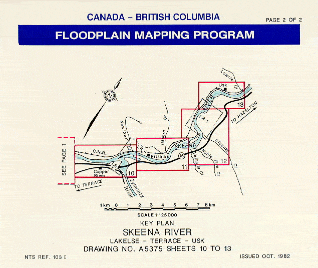
- Drawing No. 5375 Sheets 1 to 9 of 13 - Designation Date 87/12/03
- Drawing No. 5375 Sheets 10 to 13 - Designation Date 87/12/03
Somass River Drawing No. 93-10 Sheets 1 to 4 - Designation Date 97/09/30
Somenos Lake (see Cowichan River) Drawing No. 91-19 Sheets 1 to 6 - Designation Date 97/09/30
Sooke River* Drawing No. 91-4 Sheets 1 to 2 - Designation Date 95/09/30
South Thompson River: Kamloops - Chase
- Drawing No. 5113 Sheets 1 to 7 of 15 Designation Date 87/12/03
- Drawing No. 5113 Sheets 8 to 15 Designation Date 87/12/03
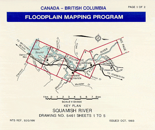
- Drawing No. 5461 Sheets 1 to 5 of 10 - Designation Date 87/12/03
- Drawing No. 5461 Sheets 6 to 10 - Designation Date 87/12/03
Stuart River and Lake at Fort St. James* Drawing No. 89-42 Sheets 1 to 7 - Designation Date 91/09/30
T
Tahsis and Leiner Rivers - Village of Tahsis
Drawing No. 89-15 Sheets 1 & 2 - Designation Date 92/09/30
Telkwa River (see Bulkley and Telkwa Rivers)
Drawing No. 84-68 Sheets 5 to 8 - Designation Date 87/12/03
Thompson and North Thompson Rivers: Kamloops Area
Drawing No. 89-15 Sheets 1 & 2 - Designation Date 92/09/30
Telkwa River (see Bulkley and Telkwa Rivers)
Drawing No. 84-68 Sheets 5 to 8 - Designation Date 87/12/03
Thompson and North Thompson Rivers: Kamloops Area
- Drawing No. 5112 Sheets 1 to 9 of 19 - Designation Date 87/12/03
- Drawing No. 5112 Sheets 10 to 19 - Designation Date 87/12/03
Drawing No. A5286 Sheets 1 to 6 - Designation Date 87/12/03
Tsolum River (see Courtenay, Puntledge and Tsolum Rivers)
Tulameen River (see Similkameen River at Princeton)
Drawing No. 91-22 Sheets 1 & 2 - Designation Date 95/09/30
Tulameen River at Tulameen Drawing No. A5294 Sheets 1 to 4 - Designation Date 87/12/03
V
Vaseux Lake* (see Okanagan River: Osoyoos to Penticton)
Drawing No. 89-12 Sheets 9 to 11 of 15 - Designation Date 93/09/30
Vedder River Drawing No. 85-53 Sheets 1 & 2 - Designation Date 87/12/03
Drawing No. 89-12 Sheets 9 to 11 of 15 - Designation Date 93/09/30
Vedder River Drawing No. 85-53 Sheets 1 & 2 - Designation Date 87/12/03
W
Whistler Area* Drawing No. 89-16 Sheets 1 to 4 - Designation Date 93/09/30
Williams Lake Drawing No. 88-46 Sheets 1 & 2 - Designation Date 90/09/30
Williams Lake Drawing No. 88-46 Sheets 1 & 2 - Designation Date 90/09/30
Z
Zeballos River* Drawing No. 89-45 sheet 1 - Designation Date 92/09/30
Zymagotitz River (see Skeena River: Lakelse-Terrace-Usk)
Drawing No. 5375 Sheets 1 to 9 of 13 - Designation Date 87/12/03
Zymoetz (Copper) River Drawing No. 84-63 sheet 1 - Designation Date 87/12/03
Alternatively use this index map to find flood hazard mapping in your area:

Chilako River
Drawing No. 93 - 1 1 to 3 - Designation Date 97/09/30


Merritt, B.C. provides a link to the current forecast model (http://bcrfc.env.gov.bc.ca/freshet/clever/08LG010.PDF?fbclid=IwAR3SRkOnca9an5e28aDFUN3sAoMXC0R9jdLE0fJgyqVRJ1xcH8nkZbqkcqs) on their flooding evacuation page: http://www.merritt.ca/floodingevacuationalertupdate/
Zymagotitz River (see Skeena River: Lakelse-Terrace-Usk)
Drawing No. 5375 Sheets 1 to 9 of 13 - Designation Date 87/12/03
Zymoetz (Copper) River Drawing No. 84-63 sheet 1 - Designation Date 87/12/03
Alternatively use this index map to find flood hazard mapping in your area:

Region 1 - Vancouver Island
Click the project name (river name in red text below) to view the key plan of the area covered.
Chemainus River Drawing No. 89-10 1 to 3 - Designation Date 91/09/30
- Drawing No. 89-13 Sheets 1 to 3 - Designation Date 91/09/30
- Drawing No. 8913 Sheets 4 to 7 - Designation Date 91/09/30
Cowichan Lake Drawing No. 84-33 1 to 6 - Designation Date 87/12/03
Cowichan,Koksilah Rivers & tributaries at Duncan Drawing No. 91-19 1 to 6 - Designation Date 97/09/30
Cowichan River - River Bottom Road Area Drawing No. 91- 33 1 & 2 - Designation Date 97/09/30
Englishman River Drawing No. 85-23 1 to 7 - Designation Date 87/12/03
Koksilah River (see Cowichan River) Drawing No. 91-19 1 to 6 - Designation Date 97/09/30
Leiner River (see Tahsis and Leiner Rivers) Drawing No. 89-15 1 & 2 - Designation Date 92/09/30
Little Qualicum River Drawing No. 93-11 Sheet 1 - Designation Date 97/09/30
McKelvie Creek (see Tahsis and Leiner Rivers) Drawing No. 89-15 1 & 2 - Designation Date 92/09/30
Nanaimo River Drawing No. 84-29 1 to 3 - Designation Date 87/12/03
Oyster River* Drawing No. 5532 1 to 3 - Designation Date 88/09/30
Puntledge River (see Courtenay, Puntledge and Tsolum R.) Drawing No. 89-13 1 to 7 - Designation Date 91/09/30
Quamichan Lake (see Cowichan R.) Drawing No. 91-19 1 to 6 - Designation Date 97/09/30
Quatse River* Drawing No. 89-7 sheet 1 - Designation Date 94/09/30
Quinsam River (see Campbell and Quinsam R.) Drawing No. 88-28 1 & 2 - Designation Date 90/03/31
Salmon and White Rivers Drawing No. A5282 1 to 6 - Designation Date 87/12/03
Shawnigan Lake* Drawing No. A5250 1 to 3 - Designation Date 88/09/30
Somass River Drawing No. 93-10 1 to 4 - Designation Date 97/09/30
Somenos Lake (see Cowichan River) Drawing No. 91-19 1 to 6 - Designation Date 97/09/30
Sooke River* Drawing No. 91-4 1 to 2 - Designation Date 95/09/30
Tahsis and Leiner Rivers - Village of Tahsis Drawing No. 89-15 1 & 2 - Designation Date 92/09/30
Tsolum River (see Courtenay, Puntledge and Tsolum Rivers) Drawing No. 89-13 1 to 7 - Designation Date 91/09/30
Zeballos River* Drawing No. 89-45 sheet 1 - Designation Date 92/09/30
Region 2 - Lower Mainland
Click the project name (river name in red text below) to view the key plan of the area covered.
Alpha Lake* (see Whistler Area) Drawing No. 89-16 1 to 4 - Designation Date 93/09/30
Alpha Lake* (see Whistler Area) Drawing No. 89-16 1 to 4 - Designation Date 93/09/30
Birkenhead River (see Lillooet River) Drawing No. 88-44 1 to 11 - Designation Date 90/09/30
Cheakamus River Drawing No. 85-15 1 to 3 - Designation Date 87/12/03
Chilliwack River: Vedder Crossing - Slesse Creek Drawing No. A5283 1 to 6 - Designation Date 87/12/03
Coquihalla River at Hope* Drawing No. 85-27 sheet 1 - Designation Date 88/09/30
Coquitlam River: Coquitlam Lake - Fraser River Drawing No. 5148 1 to 7 - Designation Date 87/12/03
Fraser River near Hope* Drawing No. 87-1 sheet 1 - Designation Date 88/09/30
Green River (see Lillooet River) Drawing No. 88-44 Sheets 1 to 11 - Designation Date 90/09/30
Green River (see Whistler Area)* Drawing No. 89-16 Sheets 1 to 4 - Designation Date 93/09/30
Green River (see Whistler Area)* Drawing No. 89-16 Sheets 1 to 4 - Designation Date 93/09/30
Lillooet River Drawing No. 88-44 1 to 11 - Designation Date 90/09/30
Mamquam River (see Squamish River) Drawing No. 5461 1 to 10 - Designation Date 87/12/03
Millar Creek (see Whistler Area)* Drawing No. 89-16 1 to 4 - Designation Date 93/09/30
Miller Creek (see Lillooet River) Drawing No. 88-44 1 to 11 - Designation Date 90/09/30
Nicomekl River (see Serpentine and Nicomekl Rivers) Drawing No. 91-5 1 to 14 - Designation Date 94/09/30
Nita Lake* (see Whistler Area) Drawing No. 89-16 1 to 4 - Designation Date 93/09/30
North Alouette River (see Alouette River) Drawing No. 89-44 1 & 2 - Designation Date 91/09/30
Pemberton Creek (see Lillooet River) Drawing No. 88-44 1 to 11 - Designation Date 90/09/30
Ryan River (see Lillooet River) Drawing No. 88-44 1 to 11 - Designation Date 90/09/30
- Drawing No. 91-5 Sheets 1 to 6 & 12 to 14 - Designation Date 94/09/30
- Drawing No. 91-5 Sheets 7 to 11 of 14 - Designation Date 94/09/30
Seymour River - North Vancouver Drawing No. 93-5 Sheet 1 - Designation Date 95/09/30
Silverhope Creek (see Fraser R. near Hope) Drawing No. 87-1 sheet 1 - Designation Date 88/09/30
- Drawing No. 5461 Sheets 1 to 5 of 10 - Designation Date 87/12/03
- Drawing No. 5461 Sheets 6 to 10 - Designation Date 87/12/03
Vedder River Drawing No. 85-53 1 & 2 - Designation Date 87/12/03
Whistler Area* Drawing No. 89-16 1 to 4 - Designation Date 93/09/30
Region 3 - Southern Interior
Click the project name (river name / red text below) to view the key plan of the area covered.
Bessette Creek (see Shuswap River, Bessette & Duteau Creeks )
Drawing No. 96 - 7 1 to 8 - Designation Date 98/09/30
Drawing No. 96 - 7 1 to 8 - Designation Date 98/09/30
Bonaparte River Drawing No. 93-12 1 to 3 - Designation Date 96/09/30
Christina Lake
- Drawing No. 89-1 Sheets 1 to 2 of 5 - Designation Date 91/09/30
- Drawing No. 89-1 Sheets 3 to 5 - Designation Date 91/09/30
Duteau Creek (see Shuswap River, Bessette & Duteau Creeks)Drawing No. 96 - 7 Sheet 8 - Designation Date 98/09/30
Eagle River Drawing No. A5187 1 to 7 - Designation Date 87/12/03
- Drawing No. 90-34 Sheets 1 to 4 of 9 - Designation Date 92/09/30
- Drawing No. 90-34 Sheets 5 to 9 - Designation Date 92/09/30
Kettle River - Midway Rock Creek Westbridge Drawing No. 93 - 13 1 to 8 - Designation Date 97/09/30
Mission Creek Drawing No. 84-43 1 to 3 - Designation Date 87/12/03
- Drawing No. 87-22 Sheets 1 to 5 of 15 - Designation Date 89/09/30
- Drawing No. 87-22 Sheets 6 to 10 of 15- Designation Date 89/09/30
- Drawing No. 87-22 Sheets 11 to 15 - Designation Date 89/09/30
North Thompson River: Kamloops - Vavenby
Drawing No. A5302 - Sheet 1 is an index map of the whole project showing all sheets.
Drawing No. A5302 - Sheet 1 is an index map of the whole project showing all sheets.
- Drawing No. A5302 Sheets 2 to 9 of 48 - Designation Date 87/12/03
- Drawing No. A5302 Sheets 10 to 16 of 48 - Designation Date 87/12/03
- Drawing No. A5302 Sheets 7 to 24 of 48 - Designation Date 87/12/03
- Drawing No. A5302 Sheets 25 to 31 of 48 - Designation Date 87/12/03
- Drawing No. A5302 Sheets 32 to 38 of 48 - Designation Date 87/12/
- Drawing No. A5302 Sheets 39 to 44 of 48 - Designation Date 87/12/03
- Drawing No. A5302 Sheets 45 to 48 - Designation Date 87/12/03
Okanagan Lake: Westbank to Peachland
Drawing No. A5289 Sheets 83 to 90 only - Designation Date 87/12/03
Drawing No. A5289 Sheets 83 to 90 only - Designation Date 87/12/03
- Drawing No. 89-12 Sheets 1 to 4 of 15 - Designation Date 93/09/30
- Drawing No. 89-12 Sheets 5 to 8 of 15 - Designation Date 93/09/30
- Drawing No. 89-12 Sheets 9 to 11 of 15 - Designation Date 93/09/30
- Drawing No. 89-12 Sheets 12 to 15 - Designation Date 93/09/30
Osoyoos Lake*(see Okanagan River: Osoyoos to Penticton)
Drawing No. 89-12 Sheets 1 to 15 - Designation Date 93/09/30
Otter Creek and Lake (see Tulameen River)Drawing No. A5294 Sheets 1 to 4 - Designation Date 87/12/03
Drawing No. 89-12 Sheets 1 to 15 - Designation Date 93/09/30
Otter Creek and Lake (see Tulameen River)Drawing No. A5294 Sheets 1 to 4 - Designation Date 87/12/03
Salmon River: Salmon Arm - Spa Creek
- Drawing No. 89-14 Sheets 1 to 3 - Designation Date 91/09/30
- Drawing No. 89-14 Sheets 4 to 6 - Designation Date 91/09/30
Salmon River: Spa Creek - Falkland
- Drawing No. 89-14 Sheets 7 to 10 - Designation Date 95/09/30
- Drawing No. 89-14 Sheets 11 to 15 - Designation Date 95/09/30
Seymour River at Seymour Arm* Drawing No. 89-11 1 & 2 - Designation Date 91/09/30
*Designated Floodplain Map WITHDRAWN
*Designated Floodplain Map WITHDRAWN
Shuswap River, Bessette & Duteau Creeks Drawing No. 96 - 7 Sheets 1 to 8 - Designation Date 98/09/30
Shuswap River: Mara Lake to Mabel Lake
- Drawing No. A5241 Sheets 1 to 10 - Designation Date 87/09/30
- Drawing No. A5241 Sheets 11 to 17 - Designation Date 87/09/30
Similkameen River at Keremeos
- Drawing No. 91-23 Sheets 1 to 4 of 7 - Designation Date 95/09/30
- Drawing No. 91-23 Sheets 5 to 7 - Designation Date 95/09/30
Similkameen River at Princeton Drawing No. 91-22 Sheets 1 & 2 - Designation Date 95/09/30
Skaha Lake* (see Okanagan River: Osoyoos to Penticton)
Skaha Lake* (see Okanagan River: Osoyoos to Penticton)
South Thompson River: Kamloops - Chase
- Drawing No. 5113 Sheets 1 to 7 of 15 Designation Date 87/12/03
- Drawing No. 5113 Sheets 8 to 15 Designation Date 87/12/03
- Drawing No. 5112 Sheets 1 to 9 of 19 - Designation Date 87/12/03
- Drawing No. 5112 Sheets 10 to 19 - Designation Date 87/12/03
Tulameen River (Similkameen River at Princeton)
Drawing No. 91-22 Sheets 1 & 2 - Designation Date 95/09/30
Tulameen River at Tulameen Drawing No. A5294 Sheets 1 to 4 - Designation Date 87/12/03
Drawing No. 91-22 Sheets 1 & 2 - Designation Date 95/09/30
Tulameen River at Tulameen Drawing No. A5294 Sheets 1 to 4 - Designation Date 87/12/03
Vaseux Lake (Okanagan River: Osoyoos to Penticton)
Drawing No. 89-12 8 & 9 of 15 - Designation Date 93/09/30
Drawing No. 89-12 8 & 9 of 15 - Designation Date 93/09/30
- Drawing No. 89-12 Sheets 5 to 8 of 15 - Designation Date 93/09/30
- Drawing No. 89-12 Sheets 9 to 11 of 15 - Designation Date 93/09/30
* Interim Designated
Region 4 - Kootenay
Click the project name (river name / red text below) to view the key plan of the area covered.
Arrow Reservoir & Kuskanax Creek (Village of Nakusp)
Drawing No. 93 - 11 Sheets 1 & 2 - Designation Date 98/09/30
Drawing No. 93 - 11 Sheets 1 & 2 - Designation Date 98/09/30
Beaver Creek - Beaver Falls to Meadows Drawing No. 88-35 1 to 5 - Designation Date 90/03/31
Columbia Lake (see Kootenay R. at Canal Flats)
Drawing No. 89-41 1 to 8 - Designation Date 91/09/30
Drawing No. 89-41 1 to 8 - Designation Date 91/09/30
Columbia River: Columbia Lake to Windermere Lake
Drawing No. A5286 Sheets 1 to 6 Designation Date 87/12/03
Columbia River at Golden Drawing No. A5186 Sheets 1 to 4 - Designation Date 87/12/03
Columbia River at Revelstoke Drawing No. 5514 Sheets 1 to 5 - Designation Date 87/12/03
Columbia River: Windermere Lake - Radium
Drawing No. A5296 Sheets 1 to 9 - Designation Date 87/12/03
Crawford Creek: Alluvial Fan Drawing No. 86-4-3 sheet 1 - Designation Date 88/09/30
Cummings Creek (see Elk River and Michel Creek)
Drawing No. 91-2 Sheets 1 to 3 of 5 - Designation Date 95/09/30
Cummings Creek (see Elk River and Michel Creek)
Drawing No. 91-2 Sheets 1 to 3 of 5 - Designation Date 95/09/30
Duncan and Lardeau Rivers Drawing No. 93-3 Sheets 1 to 5 - Designation Date 96/09/30
Dutch Creek (see Columbia R: Columbia L. to Windermere L.)
Drawing No. A5286 Sheets 1 to 6 - Designation Date 87/12/03
Dutch Creek (see Columbia R: Columbia L. to Windermere L.)
Drawing No. A5286 Sheets 1 to 6 - Designation Date 87/12/03
Elk River near Elkford*
- Drawing No. 87-30 Sheets 1 to 4 of 7 Designation Date 95/09/30
- Drawing No. 87-30 Sheets 5 to 7 - Designation Date 95/09/30
Elk River at Fernie Drawing No. A5196 Sheets 1 to 7 - Designation Date 87/12/03
Elk River and Michel Creek near Sparwood*
Elk River and Michel Creek near Sparwood*
- Drawing No. 91-2 Sheets 1 to 3 of 5 Designation Date 95/09/30
- Drawing No. 91-2 Sheets 4 to 5 - Designation Date 95/09/30
Elk River at Sparwood Drawing No. A5196 Sheets 1a & 2a - Designation Date 87/12/03
Erie Creek (see Salmo River) Drawing No. 90-32 1 to 9 - Designation Date 91/09/30
Goat River at Creston Drawing No. 84-42 1 & 2 - Designation Date 87/12/03
Illecillewaet River (see Columbia River at Revelstoke)
Drawing No. 5514 1 to 5 - Designation Date 87/12/03
Drawing No. 5514 1 to 5 - Designation Date 87/12/03
Kaslo River at Kaslo Drawing No. 5521 sheet 1 - Designation Date 87/12/03
Kootenay River: Columbia Lake at Canal Flats
Drawing No. 89-41 Sheets 1 to 8 - Designation Date 91/09/30
Drawing No. 89-41 Sheets 1 to 8 - Designation Date 91/09/30
Kootenay River: Kootenay Lake - U.S. Border
Drawing No. A5278 Sheets 1 to 6 - Designation Date 90/09/30
Drawing No. A5278 Sheets 1 to 6 - Designation Date 90/09/30
Kuskanax Creek (See Arrow Reservoir & Kuskanax Creek)
Drawing No. 93-11 Sheet 1 - Designation Date 98/09/30
Drawing No. 93-11 Sheet 1 - Designation Date 98/09/30
Little Slocan River (see Slocan River)
Drawing No. 88-26 1 to 11 - Designation Date 90/03/31
Drawing No. 88-26 1 to 11 - Designation Date 90/03/31
Michel Creek* (see Elk River and Michel Creek near Sparwood)
Drawing No. 91-2 1 to 5 - Designation Date 95/09/30
Drawing No. 91-2 1 to 5 - Designation Date 95/09/30
- Drawing No. 90-32 Sheets 1 to 4 of 15 - Designation Date 91/09/30
- Drawing No. 90-32 Sheets 4 to 6 of 15 - Designation Date 91/09/30
- Drawing No. 90-32 Sheets 7 to 9 of 15 - Designation Date 91/09/30
Slocan River Drawing No. 88-26 1 to 11 - Designation Date 90/03/31
Toby Creek (see Columbia R.: Columbia L. to Windermere)
Drawing No. A5286 1 to 6 - Designation Date 87/12/03
Drawing No. A5286 1 to 6 - Designation Date 87/12/03
* Interim Designated
Region 5- Cariboo
Click the project name (river name / red text below) to view the key plan of the area covered.
Baker Creek* (see Fraser and Quesnel R. below) Drawing No. 89-43 1 to 5 - Designation Date 92/09/30
Bella Coola River
- Drawing No. 87-56 Sheets 1 to 5 of 10 - Designation Date 89/09/30
- Drawing No. 87-56 Sheets 6 to 10 - Designation Date 89/09/30
Fraser and Quesnel Rivers at Quesnel* - Drawing No. 89-43 1 to 5 - Designation Date 92/09/30
Williams Lake - Drawing No. 88-46 1 & 2 - Designation Date 90/09/30
* Interim Designated
Region 6 - SKEENA
Click the project name (river name / red text below) to view the key plan of the area covered.
Buck Creek (see Bulkley River at Houston)
Drawing No. 85-14 Sheets 1 to 3 - Designation Date 87/12/03
Bulkley River at Houston (including Buck Creek)
Drawing No. 85-14 Sheets 1 to 3 - Designation Date 87/12/03
Bulkley River: Quick Area*
Drawing No. 86-23 Sheets 1 to 4 - Designation Date 88/09/30
Bulkley River: Quick to Houston*
Drawing No. 96-10 Sheets 1 to 6 - Designation Date 98/09/30
Bulkley River (see Skeena and Bulkley Rivers at Hazelton)
Drawing No. 91-1 Sheet 1 - Designation Date 94/09/30
Bulkley and Telkwa Rivers: Smithers - Telkwa
Drawing No. 85-14 Sheets 1 to 3 - Designation Date 87/12/03
Bulkley River at Houston (including Buck Creek)
Drawing No. 85-14 Sheets 1 to 3 - Designation Date 87/12/03
Bulkley River: Quick Area*
Drawing No. 86-23 Sheets 1 to 4 - Designation Date 88/09/30
Bulkley River: Quick to Houston*
Drawing No. 96-10 Sheets 1 to 6 - Designation Date 98/09/30
Bulkley River (see Skeena and Bulkley Rivers at Hazelton)
Drawing No. 91-1 Sheet 1 - Designation Date 94/09/30
Bulkley and Telkwa Rivers: Smithers - Telkwa
- Drawing No. 84-68 Sheets 1 to 4 of 8 - Designation Date 87/12/03
- Drawing No. 84-68 Sheets 5 to 8 - Designation Date 87/12/03
Copper River (see Zymoetz R.)
Drawing No. 84-63 sheet 1 - Designation Date 87/12/03
Drawing No. 84-63 sheet 1 - Designation Date 87/12/03
Hirsch Creek (see Kitimat River)
Drawing No. A5328 1 to 11 - Designation Date 87/12/03
Drawing No. A5328 1 to 11 - Designation Date 87/12/03
Kitimat River
Drawing No. A5328 Sheets 1 to 11 - Designation Date 87/12/03
Kitsumkalum River (see Skeena R.: Lakelse-Terrace-Usk)
Drawing No. 5375 Sheets 1 to 9 of 13 - Designation Date 87/12/03
Drawing No. A5328 Sheets 1 to 11 - Designation Date 87/12/03
Kitsumkalum River (see Skeena R.: Lakelse-Terrace-Usk)
Drawing No. 5375 Sheets 1 to 9 of 13 - Designation Date 87/12/03
Lakelse River and Lake
Drawing No. 88-29 1 to 6 - Designation Date 90/09/30
Drawing No. 88-29 1 to 6 - Designation Date 90/09/30
- Drawing No. 5375 Sheets 1 to 9 of 13 - Designation Date 87/12/03
- Drawing No. 5375 Sheets 10 to 13 - Designation Date 87/12/03
Telkwa River (see Bulkley and Telkwa Rivers)
Drawing No. 84-68 1 to 8 - Designation Date 87/12/03
Drawing No. 84-68 1 to 8 - Designation Date 87/12/03
Zymagotitz River (see Skeena River: Lakelse-Terrace-Usk)
Drawing No. 5375 Sheets 1 to 9 of 13 - Designation Date 87/12/03
Zymoetz (Copper) River
Drawing No. 84-63 sheet 1 - Designation Date 87/12/03
Drawing No. 5375 Sheets 1 to 9 of 13 - Designation Date 87/12/03
Zymoetz (Copper) River
Drawing No. 84-63 sheet 1 - Designation Date 87/12/03
* Interim Designated
Region 7 - Omineca Peace
Click the project name (river name / red text below) to view the key plan of the area covered.
Chilako River
Drawing No. 93 - 1 1 to 3 - Designation Date 97/09/30
Nahounli Creek* (see Stuart River and Lake)
Drawing No. 89-42 1 to 7 - Designation Date 91/09/30
Drawing No. 89-42 1 to 7 - Designation Date 91/09/30
Naver and Hixon Creeks at Hixon*
Drawing No. 93-9 Sheets 1 to 3 - Designation Date 96/09/30
Nechako River (see Fraser and Nechako Rivers at Prince George)
Drawing No. 91-3 Sheets 1 to 12 Designation Date 97/09/30
Nechako River at Vanderhoof
Drawing No. 5531 Sheets 1 to 3 - Designation Date 87/12/03
Drawing No. 93-9 Sheets 1 to 3 - Designation Date 96/09/30
Nechako River (see Fraser and Nechako Rivers at Prince George)
Drawing No. 91-3 Sheets 1 to 12 Designation Date 97/09/30
Nechako River at Vanderhoof
Drawing No. 5531 Sheets 1 to 3 - Designation Date 87/12/03
Peace River*: B.C. / Alberta Border to Site C
- Drawing No. 85-37 Sheets 1 to 3 of 6 Designation Date 88/09/30
- Drawing No. 85-37 Sheets 4 to 6 - Designation Date 88/09/30
Salmon River near Prince George*
Drawing No. 86-1 1 & 2 - Designation Date 88/09/30
Drawing No. 86-1 1 & 2 - Designation Date 88/09/30
* Interim Designated
***
Regarding recent flooding in Merritt, B.C. (November 2021), due to atmospheric rivers, see floodplain mapping for Nicola and Coldwater River, Spences Bridge to Nicola Lake:
Drawing No. 87-22 Sheets 1 to 5 - https://www.env.gov.bc.ca/wsd/data_searches/fpm/reports/keyplans-html/nicola-r-spences-brdg-nicola-lk-1-5.html
Drawing No. 87-22 Sheets 6 to 10 - https://www.env.gov.bc.ca/wsd/data_searches/fpm/reports/keyplans-html/nicola-r-spences-brdg-nicola-lk-6-10.html
Drawing No. 87-22 Sheets 11 to 15 - https://www.env.gov.bc.ca/wsd/data_searches/fpm/reports/keyplans-html/nicola-r-spences-brdg-nicola-lk-11-15.html
Merritt, B.C. floodplain map is on sheet 13:

link to download Merritt, B.C. map: https://www.env.gov.bc.ca/wsd/data_searches/fpm/reports/bc-floodplain-maps/Nicola_ColdwaterRiver@SpencesBr-NicolaLK/1-87-22-13.pdf
Flood flow rates projected below were above above historical maximum flows observed in 1980 and above the 200-year design flow (see stable below from floodplain mapping technical report).

